served from digilib.icpac.net
∫dX [ WORLDBATH bath ]: topography data
bath topography from WORLDBATH: ETOPO5 5x5 minute Navy bathymetry.Independent Variables (Grids)
- Longitude (longitude)
- grid: /X (degree_east) ordered (0.04166666W) to (0.04168701W) by 0.08333333 N= 4321 pts :grid
- Latitude (latitude)
- grid: /Y (degree_north) ordered (90S) to (90N) by 0.08333334 N= 2161 pts :grid
Other Info
- bufferwordsize
- 8
- CE
- 7964.0
- colorscalename
- topographycolorscale
- CS
- -9964.0
- datatype
- doublearraytype
- maxncolor
- 253
- note
- updated 27 Feb 1998 from NGDC CD-ROM 29 April 1993
- units
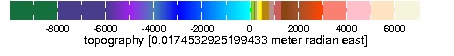
- 0.0174532925199433 meter radian east
- colorscale
Last updated: Mon, 18 Aug 2014 20:27:18 GMT
Data Views
| X | Y | |
| M | M |
|---|
Filters
Here are some filters that are useful for manipulating data. There are actually many more available, but they have to be entered manually. See Ingrid Function Documentation for more information.- Monthly Climatology calculates a monthly climatology by averaging over all years.
- anomalies calculates the difference between the (above) monthly climatology and the original data.
- Integrate along X Y
- Differentiate along X Y
- Take differences along X Y
RMS (root mean square with mean *not* removed) over X Y | X Y |
RMSA (root mean square with mean removed) over X Y | X Y |
Maximum over X Y | X Y |
Minimum over X Y | X Y |
Detrend (best-fit-line) over X Y | X Y |
Note on units