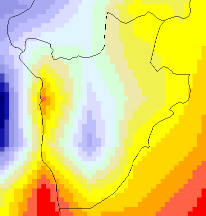
This interface allows users to view rainfall, maximum and minimum temperature climatologies
and anomalies. Climatology is defined over the period 1981-2010.
This interface allows users to view rainfall, maximum and minimum temperature climatologies
and anomalies. Climatology is defined over the period 1981-2010.
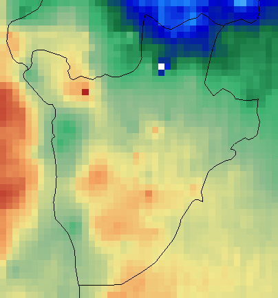
This page displays dekadal (approximately 10-day) rainfall amounts over the country.
The default map shows rainfall totals for the most recently available dekad, but totals
for previous dekads can be displayed as well.
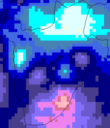
The 1-month Weighted Anomaly Standardization Precipitation (WASP) index provides a
simple visual means of extreme rainfall events for the past month, whether they are
drought or excess rainfall.
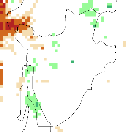
The 3-month Weighted Anomaly Standardization Precipitation (WASP) index provides a
simple visual means of extreme rainfall events for the past season, whether they are
drought or excess rainfall.
The 12-month Weighted Anomaly Standardization Precipitation (WASP) index provides
a simple visual means of extreme rainfall events for the past 12 months, whether they
are drought or excess rainfall.
This map shows the historical probability (given in percentile) of seasonal average
monthly rainfall falling within the upper (wet), middle (normal), or bottom (dry)
one-third ("tercile") of the 1981-2015 historical distribution in the region given
the state of ENSO (El Niño, Neutral, La Niña) during that same season.
This map shows the historical probability (given in percentile) of seasonal average
monthly minimum or maximum temperature falling within the upper (hot), middle (normal),
or bottom (cold) one-third ("tercile") of the 1981-2013 historical distribution in
the region given the state of ENSO (El Niño, Neutral, La Niña) during the same season.
This map shows the historical probability (given in percentile) of seasonal average
monthly rainfall falling within the upper (wet), middle (normal), or bottom (dry)
one-third ("tercile") of the historical distribution in the region given the Terciles
of IOD (Postive, Neutral, Negative) during that same season.
This map shows the historical probability (given in percentile) of seasonal average
monthly temperature falling within the upper (hot), middle (normal), or bottom (cold)
one-third ("tercile") of the historical distribution in the region given the Terciles
of IOD (Postive, Neutral, Negative) during that same season.


/(2.200S)/RANGEEDGES/X/(28.8E)/(31.0E)/RANGEEDGES/a-/-a/SOURCES/.WORLDBATH/.bath/X/21/52/RANGE/Y/-12/22.2/RANGE/1/index/SOURCES/.Features/.Political/.ICPAC_coarse/.Districts/.the_geom/SOURCES/.Features/.Political/.ICPAC_coarse/.Regions/.the_geom/SOURCES/.Features/.Political/.ICPAC_coarse/.Countries/.the_geom/X/Y/fig-/colors/colors/%7C%7C/colors/lightgrey/verythin/stroke/grey/thinnish/stroke/black/thin/stroke/-fig//layers%5B//wasp8110//Districts//Regions//Countries%5Dpsdef/T/last/plotvalue//plotborder/0/psdef//plotaxislength/432/psdef//color_smoothing/1/psdef+.gif)


